DOLAR
46,3233 0.06%
EURO
53,8690 0.14%
ALTIN
6.472,260,39
BITCOIN
3024180-0.74167%
Lefkoşa
°
SABAHA KALAN SÜRE
SABAHA KALAN SÜRE

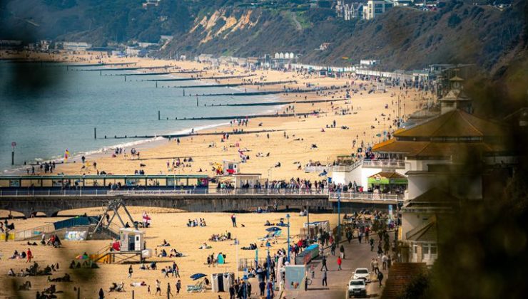
The UK is expected to enjoy 18C sunshine today which forecasters say could be the warmest day of the year so far – but the Met Office has issued a yellow weather warning for later in the week.
The temperature is likely to surpass that of some Greek islands including Santorini, Mykonos and Crete, where many people have travelled for the Easter holidays.
High pressure moving across the nation has “timed itself nicely”, the Met Office said.
However, people have been urged not to underestimate the strength of the sun, with UV levels as strong as the “back end of the summer”, bringing the risk of sunburn.
Met Office forecaster Craig Snell said the weather for the chunk of the UK is going to be fairly reasonable.
“The only place we’ll probably see a change is Northern Ireland where it’ll turn increasingly breezy, cloudy and eventually damp,” Mr Snell said.
“But for the most part it will be fairly sunny and temperatures may peak at around 18C – so, pleasantly warm out there.”
The warmest day of 2023 to date was on 30 March when a temperature of 17.8C was recorded in the Suffolk village of Santon Downham.
Open Privacy Options
Open Privacy Options
However, the Met Office has issued a yellow weather warning for strong winds on Tuesday and Wednesday.
Advertisement
The warning covers parts of Northern Ireland, southwest Scotland, Wales and western England. It will last from 3pm on Tuesday to 6am on Wednesday.
It has issued another yellow warning for strong winds from 6am to midnight on Wednesday which covers parts of Scotland and southwest England.
This is what the yellow warning means, according to the Met Office:
• Some delays to road, rail, air and ferry transport are likely• Some bus and train services will probably be affected, with some journeys taking longer• Delays for high-sided vehicles on exposed routes and bridges likely• Some short-term loss of power and other services is possible• It’s likely that some coastal routes, seafronts and coastal communities will be affected by spray and/or large waves
Gusts of 45-50mph are possible inland and perhaps in excess of 60mph for a time around some Irish Sea coastal areas.
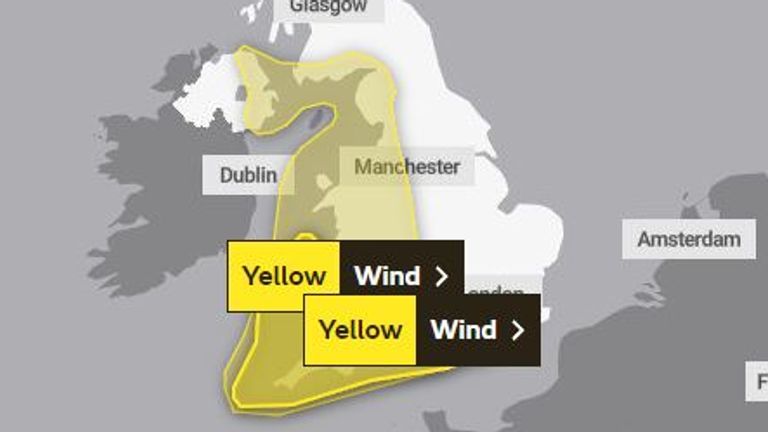
Image:
Pic: Met Office
An estimated two million British holidaymakers are thought to have travelled abroad during the Easter bank holiday weekend, according to the travel trade organisation, ABTA.
But anyone arriving back next week can expect a wet welcome home, with unsettled conditions likely to continue on Easter Monday and through the week.
Read more: Met Office: March was England’s wettest in 40 yearsWhy Europe could see repeat of severe 2022 droughts
Easter Monday washout
Mr Snell warned it would turn “wet and windy” as we go into next week.
“Monday is certainly going to be that day of change, as low pressure starts to dominate the scene.
“With blustery showers, it’s the day to do anything you want indoors.”
Met Office chief meteorologist, Jason Kelly, added: “A change is on the way for the UK weather as the dry, settled, and in places warm conditions are replaced by a more unsettled weather pattern from Sunday afternoon.
“This change happens first for Northern Ireland and Scotland, where Sunday afternoon rain will be replaced by blustery showers overnight and into Monday.”
Be the first to get Breaking News
Install the Sky News app for free


![]()
A low-pressure system is set to bring a “sustained period of wet and windy weather” from Tuesday and into Wednesday, with the potential for heavy rainfall and even snow – although this will probably be confined to high ground in the north of the UK, the Met Office said.
Winds could reach speeds of 70mph in some exposed upland or coastal regions, with downpours set to dump up to 40mm of rain, although the forecast remains uncertain at this stage.